
Today the
San Gabriel Mountains
Trailbuilders teamed up with the
California Conservation
Corps and students from
Mount San Antonio College to continue
work on the
East
Fork Trail along the
San
Gabriel River located within the
Angeles
National Forest.
The effort today was continued trail repairs beyond the John Seals
Bridge which spans Laurel Gulch approximately 2 miles from the
Heaton Flats
trailhead. The East Fork Trail follows the river all the way to the infamous
Bridge
To Nowhere which makes this particular trail much loved by hikers regardless of the weather.
In addition to furthering the trail maintenance beyond the John Seales Bridge,
the Bridge itself was on today's list for maintenance in that the old twisted
foot bridge that the Trailbuilders made obsolete by building the new bridge
continued to remain under the new bridge for the past 3 years, making it look
rather untidy, so the old bridge was to be cut up and removed, hauled out of
the forest.
Also we wanted to take another look at the two new river crossings in the
on-going effort to redirect hikers around the rock cliff face that is still
coming down at approximately 1.56 miles on the trail. The rock that came down
continues to be something of a safety hazard, yet the rock that continues to
come down literally every day also constitutes a significant hazard, so the
Trailbuilders have worked a bypass.
We met at the
Gateway
Information Center maintained by the
Forest
Service above the City of
Azusa. Promptly
at 8:00 we packed in to our vehicles and headed North on
Highway
39 to the
Rincon
Fire Station(PDF file) to collect our tools and equipment, then we turned
around and crossed the East Fork Bridge and assembled at Heaton Flats.
Along the way I called to our
L. A.
County Dispatch facility to inform them where the volunteers would be
working today since being in the field means we may be called by radio to
provide public assistance for the area, if needed, while also allowing
Dispatch to inform us of any hazards or evacuations, weather or other issues
which may come up during the day.
Today started with our daily
Job Hazard
Analysis where the local flora, fauna, and environmental safety issues
were covered, followed by a brief review of the tools and equipment that
would be used to work on the trail today. Because of the rock that continues
to come down the canyon walls, proper
Personal
Protective Equipment was also covered, making sure everyone had a hard
hat and gloves.
Once the JHA and
Project
Activity Level was reviewed, we headed toward the John Seales Bridge
and got to work.
What we found was that the bypass we had established around the hazardous
cliff face coming down was still in place, the blockage established in the
effort to stop people from climbing over or through the rock was not
entirely successful however the two new river crossings we provided were
being used by almost everyone, so no additional work was needed there.
One team stayed at the John Seales Bridge to leverage the old twisted bridge
underneath out to where it could be cut up with a chainsaw while the larger
group continued on in to the
Sheep
Mountain Designated Wilderness. It had been a fairly large number of
years since we had last worked in the
Wilderness however
reports from hikers tended to indicate that there were no serious trail
issues that actually obstructed the trail -- and in fact we were informed
about the cliff face that had come down a year after it had fallen which
meant we can't entirely rely upon hikers to report issues, usually because
hikers believe that they have already been reported.
So it was something of a surprise to find a number of significant trail
issues past the John Seales Bridge. The first was trail erosion at a point
where another water source drains in to the San Gabriel River, a concrete
sluice-way where both approaches were badly eroded and somewhat mildly
hazardous. In addition the walk through the sluice-way meant stepping down,
walking across, and stepping up while stepping through flowing water.
That point in the trail was heavily re-worked, both approaches were greatly
improved while large boulders were hauled in to the concrete sluice to
establish dry footing across the water source.
Bayonet Yucca was
cut back and the trail widened on the approaches so that hikers no longer
had to jump on the slopes while also avoiding getting stuck by the plant's
spines.
While that effort continued another team split off to continue working further
up the trail, widening at choke points and removing boulders, establishing
stepping stones and doing incremental improvements on the way to the next
significant issue.
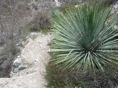
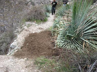
The next issue was an erosion depression flanked by a 20 feet drop on one
side and three Bayonet Yucca on the other side. We watched to see how hikers
negotiated the hazard and decided that either the Yucca had to be removed
entirely or the plants needed to be cut back significantly while the
surrounding area could be harvested for dirt and rock fill as a temporary
measure to make crossing the spot safer.
That was a one-person job so I parked myself at that effort and got to work
while the rest of the larger team continued on down the trail, turned the
bend, and found a large dirt and rock slide obscuring the trail. That
obstruction had a seriously-used temporary bypass trail established by
hikers so once again we found a known trail issue that had not been reported
to us.
The Conservation Corp and other volunteers got to work on that large slide,
digging up the compacted slide and widening that point of the trail while
not bothering to obscure the temporary use-trail that hikers had established.
The removal of the old twisted foot bridge out from under the John Seals
Bridge was accomplished and the team working on that had time to spare, so
they returned to where the cliff face is coming down and examined the area
in terms of the
geologist review of the
rock still left to come down. The bypass we had established previously was
altered on one of the approaches by this team, the distance from the cliff
face coming down was increased, and the next volunteer effort will see the
other approach distance increased with the associated trail on the far side
of the river which bypasses the hazard reworked for easier hiking.
Toward the evening we were finished for the day, everyone met at Heaton
Flats, checked the campground to break up illegal fire rings, then we
returned to the Rincon Fire Station where we examined and stored our tools,
informed Dispatch we were out of service, and were finished for the day!
On the way down the mountain one of our Trailbuilders got flagged down by a
forest visitor, informing him that there was a vehicle over the side. Since
the Trailbuilders did not have a radio he awaited myself and two other
Trailbuilders who had a radio, flagged us down, and we called in the vehicle
over the side.
Bryan
rappelled down the 150
foot slope to check for human remains or living passengers and found the
vehicle apparently unoccupied and with no visible human remains under or
around the vehicle. He acquired the plate number by writing it in felt
marker on his arm while a volunteer established a better climbing rope
from the highway down to the vehicle.
This incident was good training for the four Trailbuilders in that we got
to work with Dispatch and professionally examined the region for possible
medical emergency. Another Trailbuilder rappelled down the slop to the
vehicle to double-check the area for injured passengers who might have been
ejected from the vehicle, systematically examining the whole distance.
Also the incident appeared to be a good source of training for the responding
agcnies in that everybody seemed to get called out, from law
enforcement, fire, ambulance, helicopter, and even the
San Dimas Mountain Rescue Team which is a
highly decorated volunteer
SAR that
trails and operates within these canyons.
What was amusing was the need for every responding agency to acquire a
license plate number so when anyone asked, Bryan go to walk over and show
the person making their agency reports his arm. :)
So many emergency responders were showing up that the Trailbuilders were
somewhat worried that our vehicles would get trapped, and since we were no
longer needed for traffic control or any other effort, we continued on down
the mountain.
And fun was had by all! Except for the person who owned that stolen
vehicle. :) What was also amusing is that on Facebook I received a message
from a witness who spoke with the people who stole the vehicle and shoved
it over the side. Two vehicles were pretend with two men visible, the stolen
vehicle was hung up on the edge of the ravine and the witness though there
had been an accident.
The car thieves informed her that
AAA
had been called and that a tow truck was on the way. That was at 3:00 A.M.
on this Saturday morning. When the witness was gone, the two men continued
to shove the vehicle over the side. What fun!
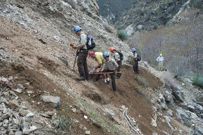
 Removing the rock/dirt slide, in progress
 Removing the rock/dirt slide, in progress
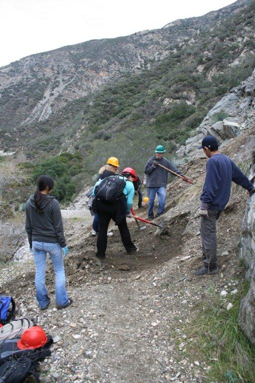 Removing the rock/dirt slide, in progress
 Half way there, the dirt is almost all removed
 All removed, some additional trail dressing is needed
 Me, pausing to allow some hikers to take my photograph :)
 Trailbuilders at Heaton Flats at the end of the day
 CCC crews at Heaton Flats at the end of the day
 The old twisted bridge under the new John Seales Bridge
 The old twisted bridge under the new John Seales Bridge
 The old twisted bridge under the new John Seales Bridge
 The old bridge has been extracted and awaits dismemberment!
 The old bridge has been extracted and awaits dismemberment!
 A rock bar is used to lift the tread from off the telephone poles
 Half of the tread has been removed so far
 Almost all of the tread has been removed
 And the whole twisted bridge has been ripped apart
 The unfettered bridge. Spray paint and the rest are going to be fixed soon
 The unfettered bridge. Spray paint and the rest are going to be fixed soon
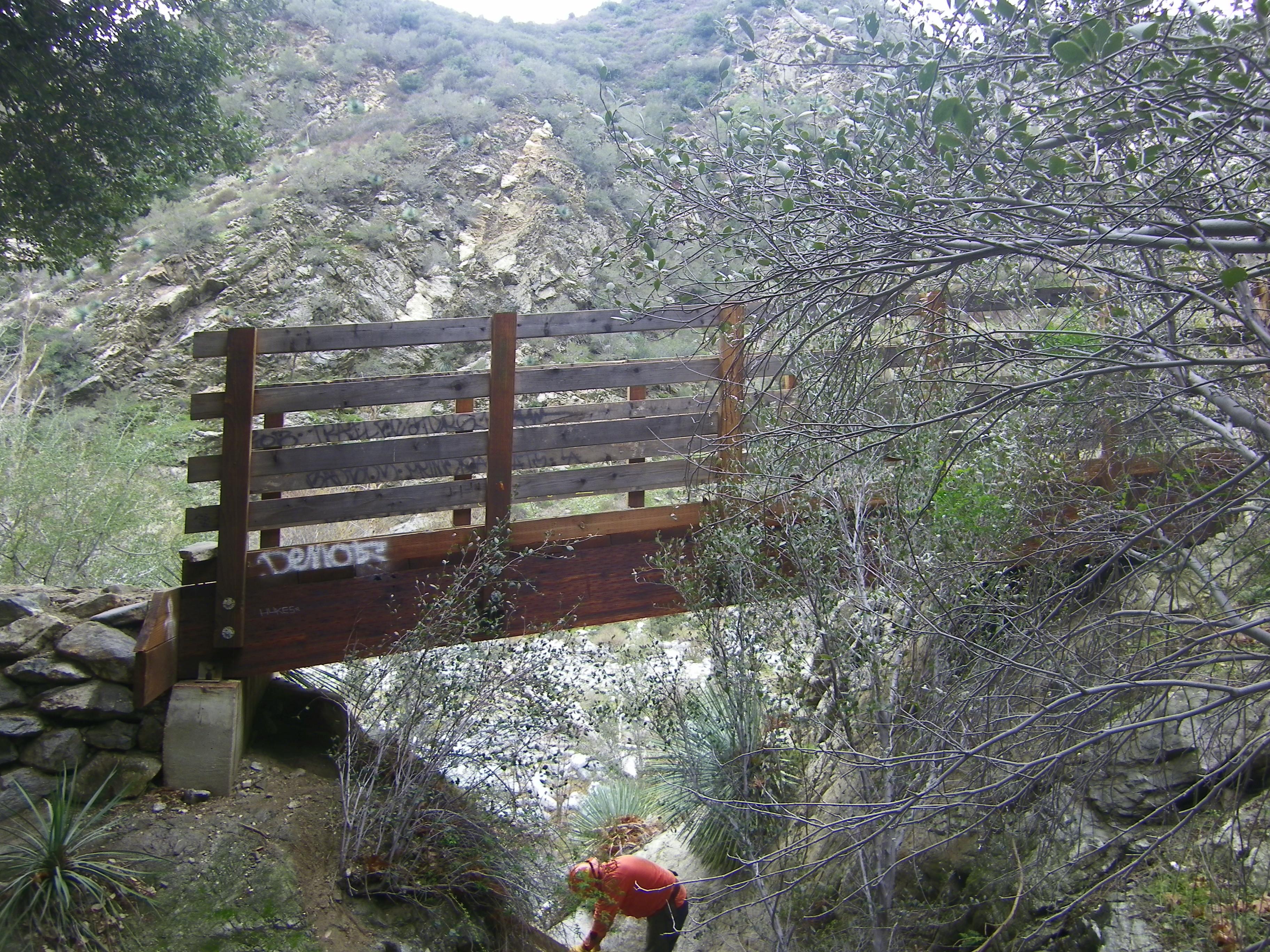 The unfettered bridge. Spray paint and the rest are going to be fixed soon
 All of the parts of the old bridge must be carried out of the forest
 Laurel Gulch is crossing has the old bridge completely removed! Joy!
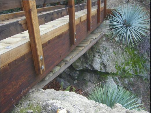
 A look at the bottom of the John Seals bridge
 Another look at the unfettered bridge
 Goat! Ram! Some critters far above us knocking rocks down the hillside
 Volunteers leaving Heaton Flats and hitting the trail
 Volunteers leaving Heaton Flats and hitting the trail
 The first river crossing, the water level is low
 Volunteers waiting to cross the river
 The first river crossing, the water level is low
 The first river crossing, the water level is low
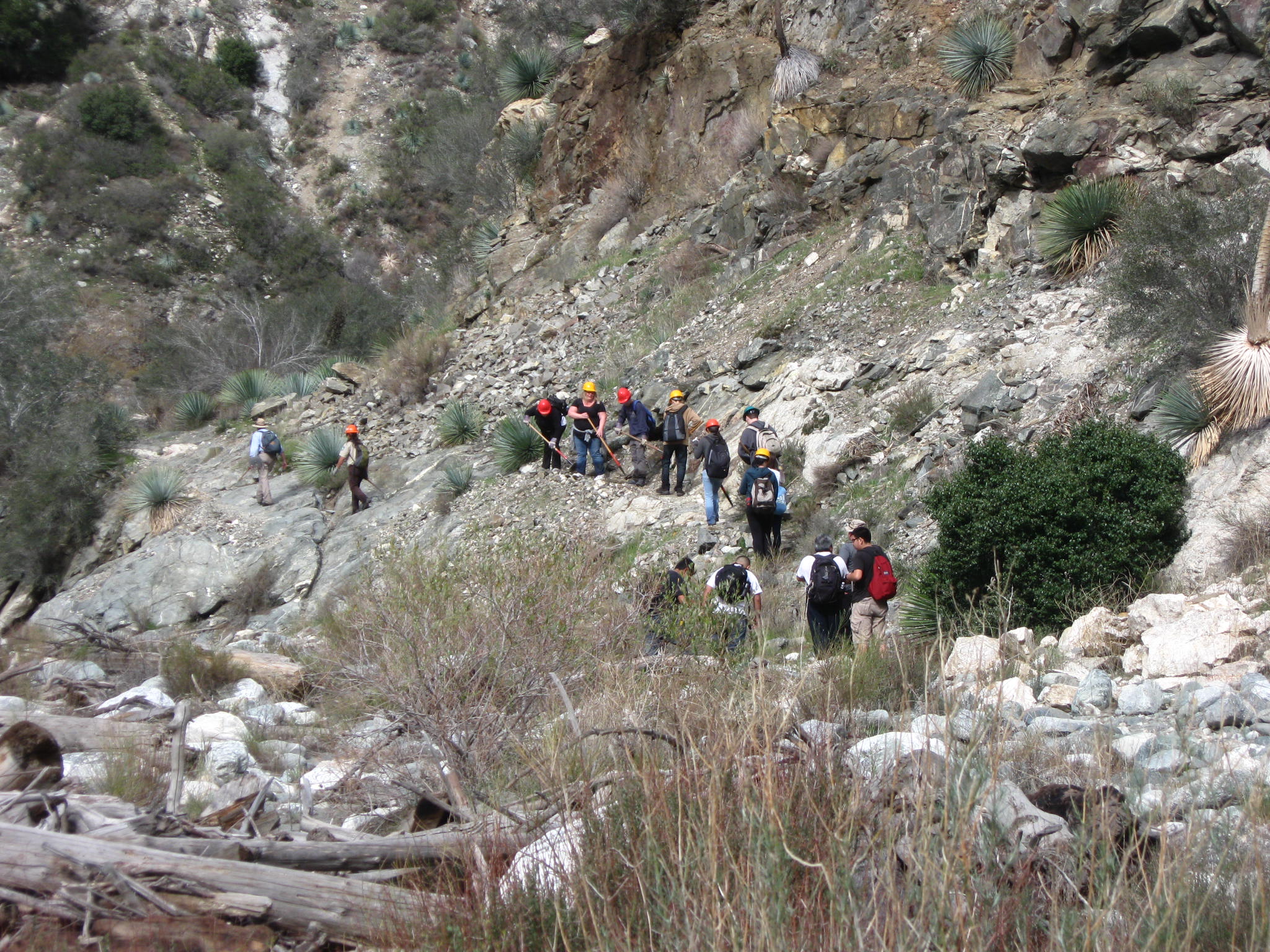 The first trail section to be worked after the John Seals Bridge
 Three Legged dog out for a hike!
 The third river crossing about 2 miles in
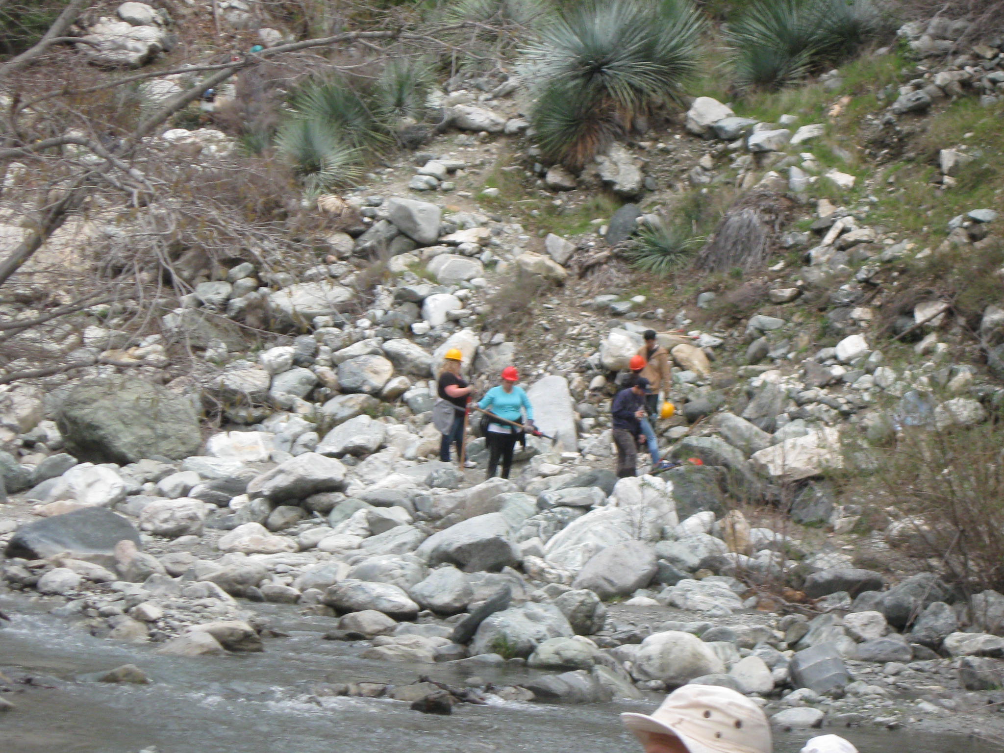 Working on the up-slope, extensive work was done here
 The slope here was greatly worked, boulders removed, tread widened
 Rocks removed and soil/rock placed to provide an actual trail
 One of the safety hazards along the way, 20 foot drop on one side
 The safety hazard reworked
 The dirt slide being worked, tool over the head is not encouraged!
 Dirt slide repaired
 Concrete sluice-way gets stepping stones to cross it now, approached worked
 A look down the river where people walk along the rock face
 One of the newly-worked approaches to the concrete sluice-way
 Stepping boulders placed within the concrete sluice-way
 One of the newly-worked approaches to the concrete sluice-way
 One of the newly-worked approaches to the concrete sluice-way
 On the hike back additional incremental improvements are performed
 Re-crossing the river on the way back to Heaton Flats
 Re-crossing the river on the way back to Heaton Flats
 Re-crossing the river on the way back to Heaton Flats
 Re-crossing the river on the way back to Heaton Flats
 Re-crossing the river on the way back to Heaton Flats
 Vehicle over the side -- This is what can be seen without zoom
 Here is the vehicle with a bit of zoom
 Vehicle hung up here and left plastic debris
 Helicopter Fire rescue comes in where we called for a response
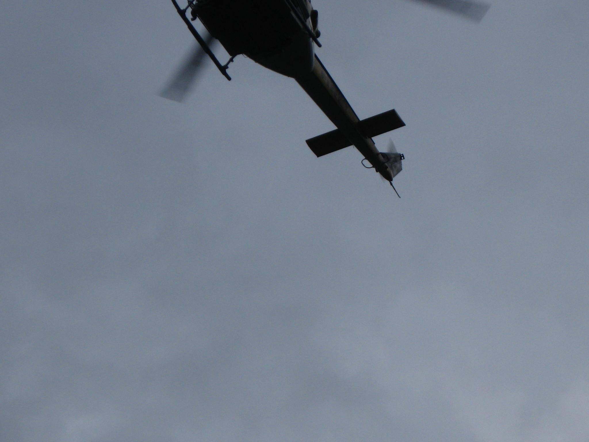 Helicopter Fire rescue comes in where we called for a response
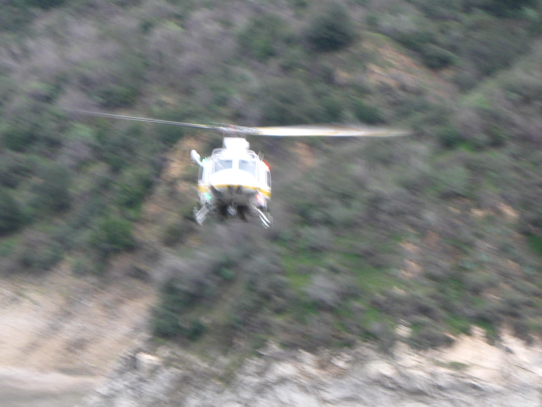 Helicopter Fire rescue comes in where we called for a response
 Helicopter Fire rescue comes in where we called for a response
 I want one of these helicopters
 Helicopter fire, law enforcement, Forest Service first on the scene
 Hook and ladder positions for traffic control and medical rescue
 Helicopter again, searching the water for floating human remains
 More rescue/emergency vehicles, fire crews performing traffic control
 Close up: Hook and ladder positions for traffic control and medical rescue
 Final work on the approaches to the concrete sluice-way
 Final work on the approaches to the concrete sluice-way
This web site is not operated or maintained by the US Forest Service, and
the USFS does not have any responsibility for the contents of any page
provided on the http://CrystalLake.Name/ web site. Also this web site is
not connected in any way with any of the volunteer organizations that are
mentioned in various web pages, including the
San Gabriel Mountains
Trailbuilders (SGMTBs) or the
Angeles Volunteers Association
(AVA.) This web site is privately owned and operated.
Please note that information on this web page may be inaccurate.